I started shop.sknowed.com because, honestly, I love two things: skiing and maps. (Okay, and maybe beer, but that’s another story.) While building sknowed.com—a site with 3D terrain maps for over a thousand ski resorts—I found myself knee-deep in OpenStreetMap data, feeding it into QGIS, crunching piste lengths, elevations, lift counts, and all the nerdy details only a map-obsessed skier could get excited about.
Somewhere between counting chairlifts and wondering if my laptop would ever forgive me for all those calculations, I thought: “These maps are too cool to stay on a screen. What if you could actually sleep under them?”
And that’s how shop.sknowed.com was born. Now you can hang ski maps on your wall, wrap yourself in them on a blanket, or basically live inside the mountain data I’ve been geeking out over. It’s like bringing après-ski vibes straight into your living room—minus the soggy boots.
While sknowed.com is completely automated (think: download data → run 30+ calculations → ship it into Mapbox → render → pull in weather data → boom, live maps), shop.sknowed.com is not… well, not that much. Each print map is handcrafted in QGIS and Affinity Designer. For example, in Japan, I sometimes buy extra data covering buildings, roads, railroads, contours, cliffs, vegetation—you name it. Then I stack on a digital elevation model, layer in some hill shading magic, and finally export it to Affinity Designer, where I tweak and polish until it’s print-ready at high resolution. Every map is made one by one. So, if your favorite resort isn’t on shop.sknowed.com yet but you see it on sknowed.com, just reach out—I’ll happily custom-build it for you and everyone (will add it to the shop). I can even add your epoch wipe out with “X marks the spot”, if you want!
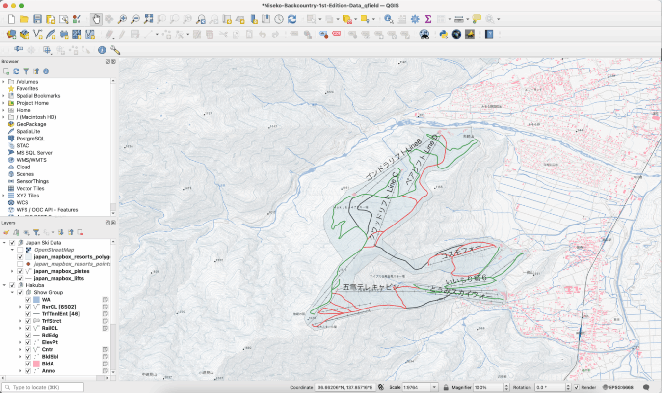
Using QGIS to create Hakuba Goryu Ski Map.
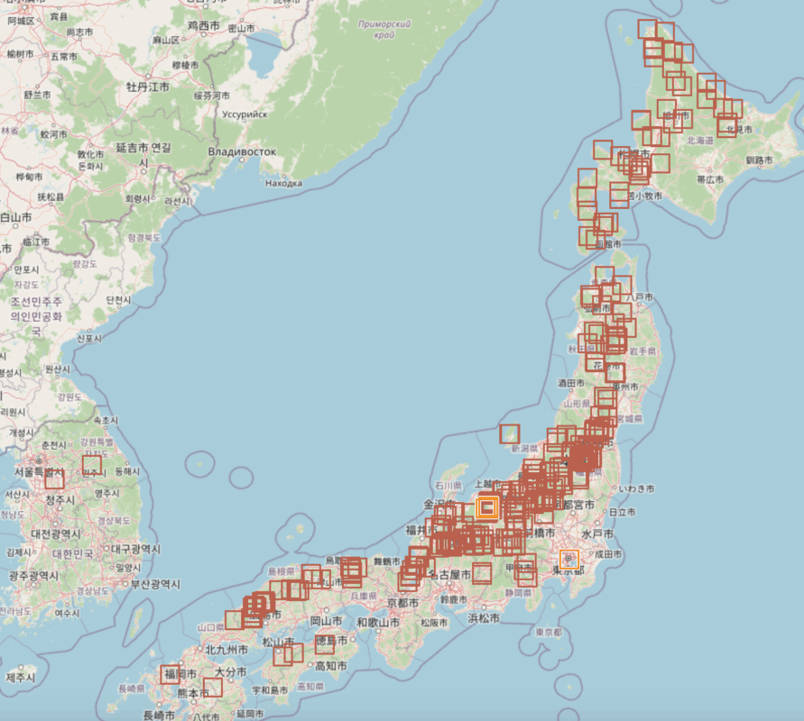
Most of the data I map comes from Openstreepmap.org. Contributors are global and add, update, create and sometimes even delete ski resort data including pistes (ski runs), chairlifts, pylons, polygons (showing the resort extent), etc. I am also updating these properties via openstreetmap.org. Over the last few years, I have contributed over 16,000 updates and counting mainly in Japan but also South Korea, Australia, New Zealand, Canada and the USA. All my contributions are in fact downloadable for free.